Maps Metadata
Maps Metadata can be Edited by clicking the Edit Metadata link from the Map Detail page.
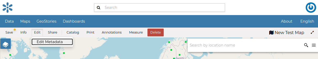
The Map Metadata Detail link
The Map Metadata Edit form will open. | Metadata provide essential information for the identification and the comprehension of the map. They also make the map more easily retrievable through the search tools. | Those Metadata can be filled out through three-steps in which you have to provide all mandatory information to complete the process. Those three steps are described below.
Basic Metadata
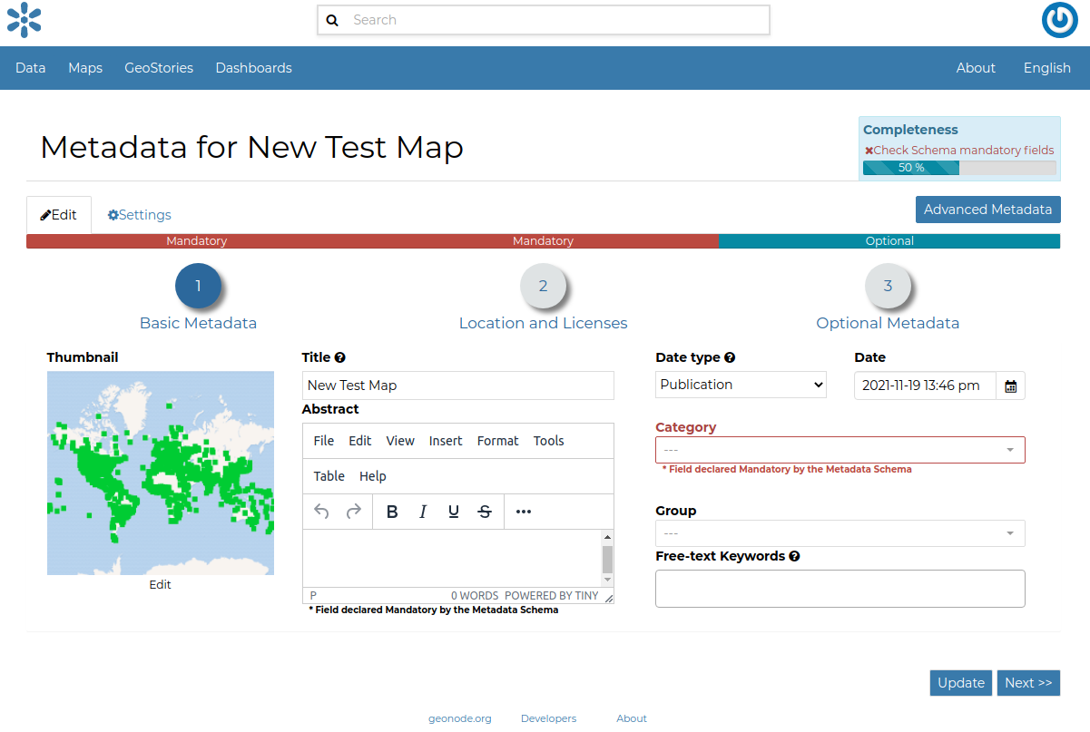
Basic Map Metadata
In the first step the system asks you to insert the following metadata (required fields are highlighted with red outlines):
Thumbnail of the map (click Edit to change it);
Title of the map, which should be clear and understandable;
Abstract; brief narrative summary of the content of the Map
Note
The Abstract panel allows you to insert HTML code through a wysiwyg text editor
Creation/Publication/Revision Dates which define the time period that is covered by the map;
Keywords, which should be chosen within the available list;
Category which the map belongs to;
Group which the map is linked to.
Click Next >> to go to the next step.
Location and Licenses
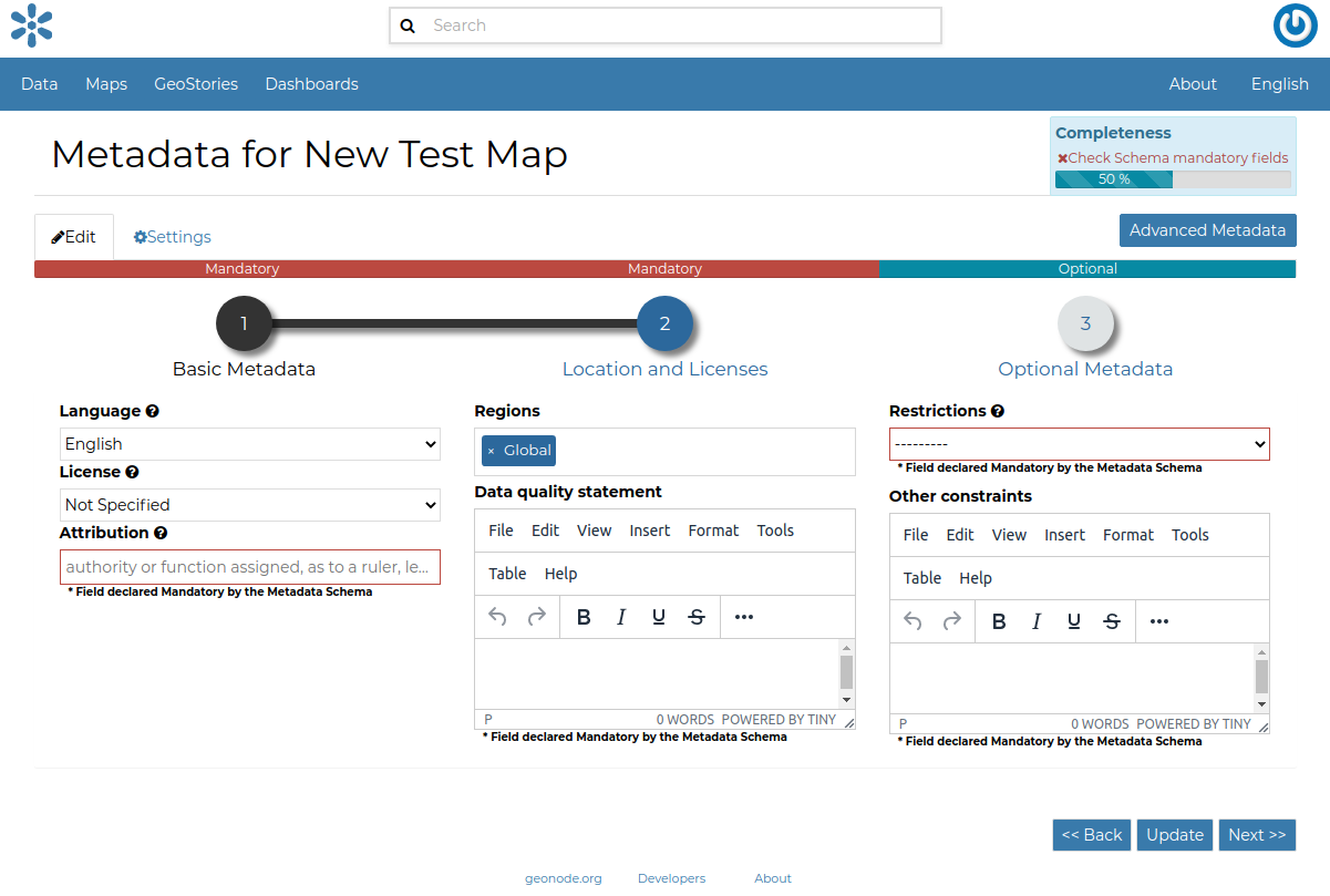
Location and Licenses Metadata for Maps
The following list shows what kinds of metadata you are required to enter (see also the picture below):
Language of the layer;
License of the dataset;
Regions covered by the layers extent. Proposed extents cover the following scales: global, continental, regional, national;
Data Quality statement (general explanation of the data producer’s knowledge about the lineage of a dataset);
Potential Restrictions on layer sharing.
No further mandatory metadata are required in the next step so, once the required fields have been filled out, a green Done button will be visible in the screen. Click Next >> to go to the next step or << Back to go back to the previous step.
Optional Metadata
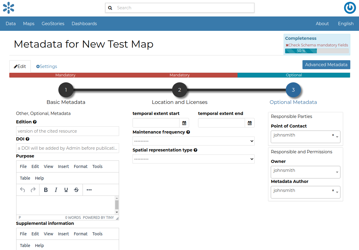
Optional Map Metadata
Complementary information are:
Edition of the map;
Purpose of the map and its objectives;
Supplemental information that can provide a better understanding of the map;
Maintenance frequency of the map;
Spatial representation type, the method used to represent geographic information in the dataset;
Users who are Responsible for the layer, its Owner, and the Author of its metadata;
Related resources to link one or multiple resources to the document. These will be visible inside the Map Information panel
If you miss some mandatory metadata the Completeness bar shows you a red message like the one in the picture below.
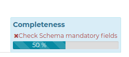
Completeness Progress Bar
Metadata Advanced Editing
The Advanced Metadata editing button in the Metadata Edit form allows to change the map metadata.
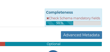
The Advanced Edit button
Click on it to display the Metadata Advanced Editing Page. That page allows you to edit all the map metadata described in the previous paragraph.
Once you have finished to edit them click on Update to save your changes.