Map Information
From the Map Search Page (see Finding Data) you can select the map you are interested in and click on its name to see an overview about it.
The information panel reports:
The Info tab is active by default. This tab section shows some map metadata such as its title, the abstract, date of publication etc. The metadata also indicates the map owner, what are the topic categories the map belongs to and which regions are affected.
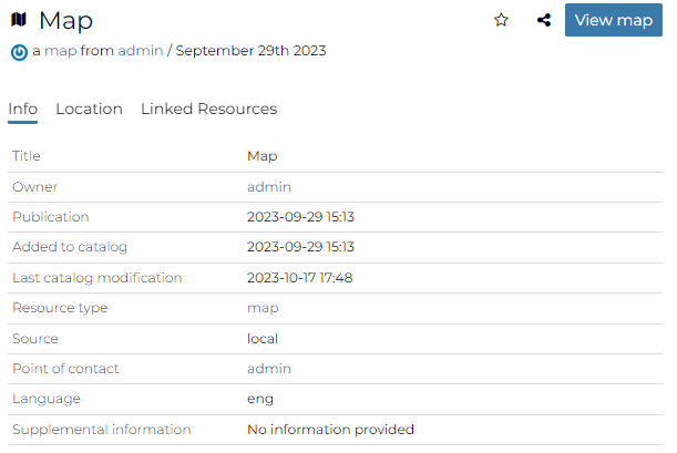
Map Info tab
The Location tab shows the spacial extent of the map.
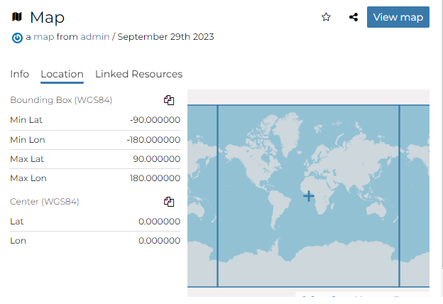
Map Location tab
By clicking on the copy icons you have a copy of the current Bounding Box or the Center in the clipboard which once pasted will be a WKT text.
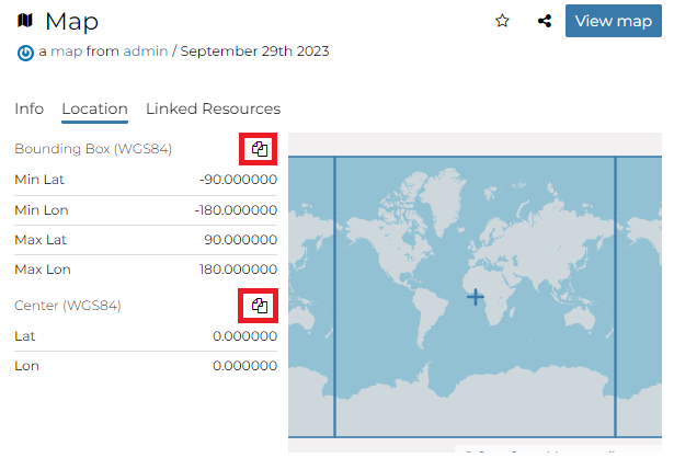
Bounding Box and Center
The Linked Resources tab shows resources, that can be Documents, Datasets, GeoStories and Dashboards, linked to the map.
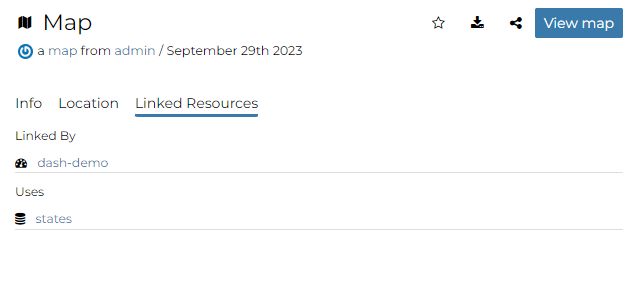
Map Linked Resources tab
Note
When a resource is linked from the map the link is shown under the Linked by list while when a resource is linked to the map the link is shown under the Used by list
From the right toolbar on the Info panel it is possible:
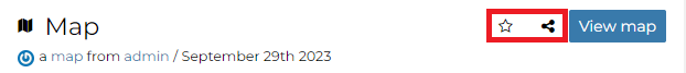
Map Info toolbar
Add map in your Favorites (see Updating the Profile), clicking on star icon.
Share the map url
Change the map Title by clicking on it
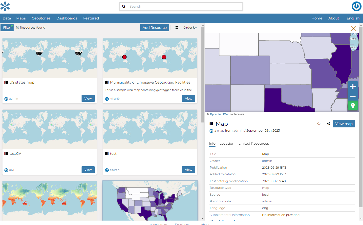
You can access the map details page by clicking on View map in the overview panel. That page looks like the one shown in the picture below.
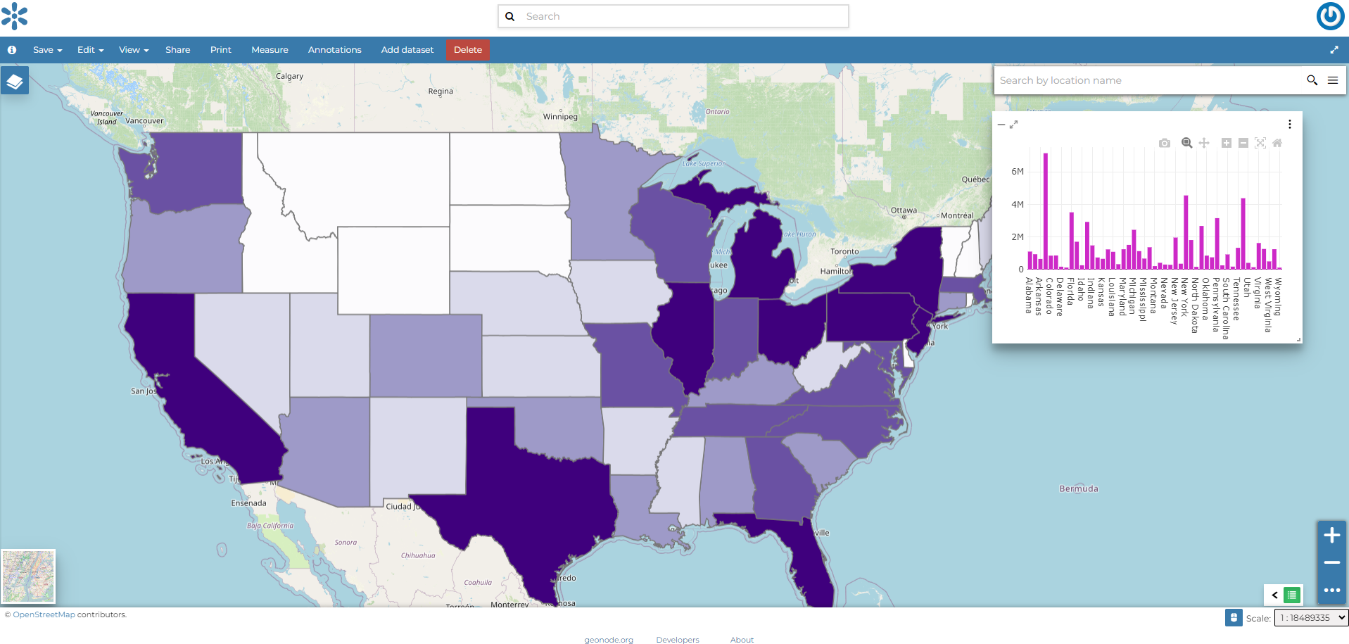
Map page
The Map Viewer shows the map with very basic functionalities:
the Base Map Switcher that allows you to change the base map;
the Zoom in/out tool to enlarge and decrease the view;
the Zoom to max extent tool for the zoom to fit the datasets extents;
the Query Objects tool to retrieve information about the map objects by clicking on the map;
the Print tool to print the preview.
the Measure tool to measure Distances, Areas and the Bearing of lines.
the Annotations tool to add an annotation to the map